Ada Huja [Serbia] - Historical maps
Ada Huja, Ostrvo Huja
Related maps

Administrative Maps of Hungary (1914)

Europe in the XIX. century

Europe in the XIX. century (with the Third Military Survey)

Europe in the XVIII. century
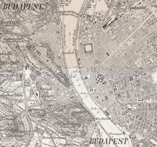
Habsburg Empire (1869-1887) - Third Military Survey (1:25000)

Habsburg Empire (1869-1887) - Third Military Survey (1:75000)

Habsburg Empire - Cadastral maps (XIX. century)

Hungary (1819–1869) - Second military survey of the Habsburg Empire

Magyarország általános térképe (foktérkép) 1910 körül (1:200 000)

Magyarország etnikai térképe - Anyanyelvek 1910 körül (1:200 000)

Magyarország felekezeti térképe - Vallások 1910 körül (1:200 000)

Temeschwarer Banat (1769–1772) - First Military Survey

The German language area and settlements of Austria-Hungary (1919)


